24 Hours Hiking Capitol Reef National Park in Utah
Native Americans called this place the “Land of the Sleeping Rainbow”, with all of the vibrant colors of rock due to a rare geological anomaly, a 100 mile buckle in the earth’s crust, running through the center of this least visited but perhaps most gorgeous Utah national park.
Capitol Reef National Park is named in part due to great white rock formations, one of which resembles the U.S. Capitol building, and the other half of its name Reef because early explorers compared this buckle in the Earth’s crust to an ocean reef, an obstacle difficult to navigate.
This park has no crowds and its views will blow you away with plenty of easily accessible sights and hikes for various ability levels.
Centrally located just a couple of hours drive from the very popular Arches National Park to the north or the overcrowded Zion and Bryce Canyon National Parks to the south, Capitol Reef National Park is an easy day trip and an even better overnight trip.
ITINERARY
Highway 24 (Panorama Point)
Petroglyphs
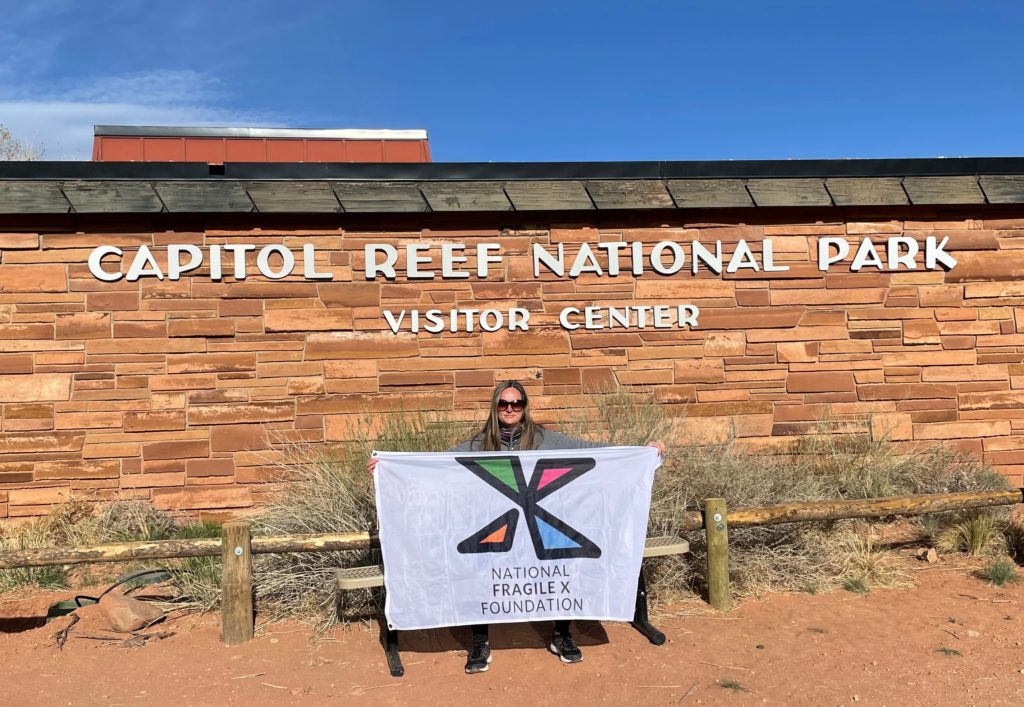
The Visitor Center
Scenic Drive
Gifford Homestead
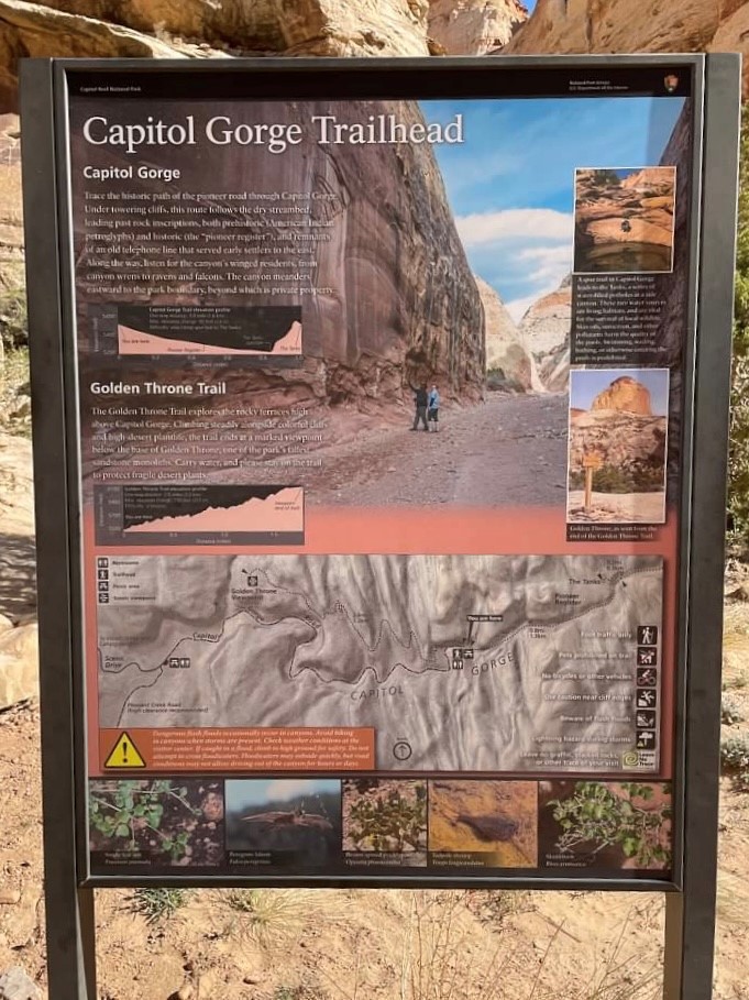
Hike Capitol Gorge Trail
Hike Grand Wash
Gooseneck Overlook
Hike Sunset Point
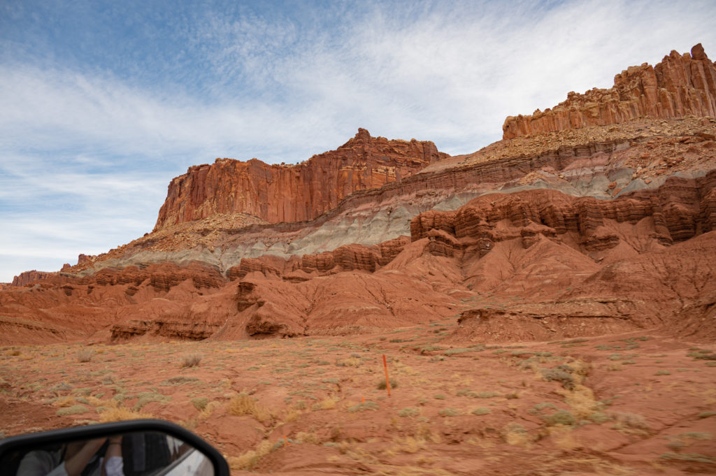
The drive from Moab, Utah to Capitol Reef was one of the most bizarre terrains we’ve ever seen, resembling scenes from planets in distant galaxies seen in Star Wars rather than Earth.
About 50 millions years ago, the Colorado Plateau (the 4 corners area of the Southwest including much of AZ, UT, CO, and NM comprised of a series of plateaus located within a huge basin surrounded by highlands) was slowly lifted when an ocean tectonic plate dove underneath the North American continental plate in an event called the Laramide Orogeny, and it dramatically reshaped most of western North America.
Remarkably, the landscape of the Colorado Plateau remained relatively flat despite being raised more than 7,000 feet.
Plate tectonic movement can cause rocks in the Earth’s crust to fold or fracture, creating faults, and can happen slowly or suddenly exposing this rock that’s been under the Earth’s surface, uncovering some of the most colorful massive stone you’ll ever see.
The rocks that form the majority of the landscape in Capitol Reef are from the Age of the Reptiles, when dinosaurs rose and fell, called the Mesozoic Era which took place between 250-66 million years ago.
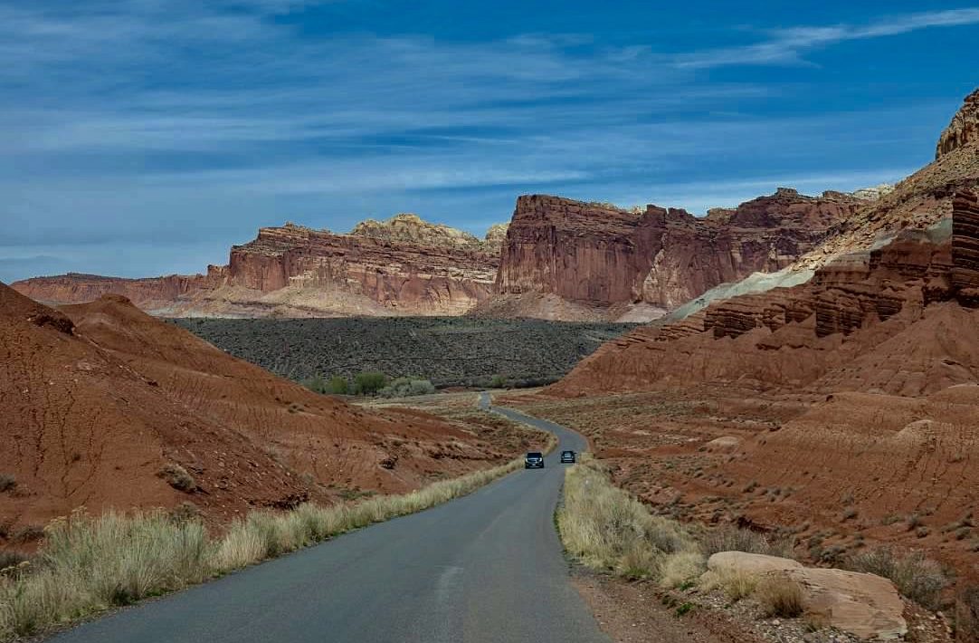
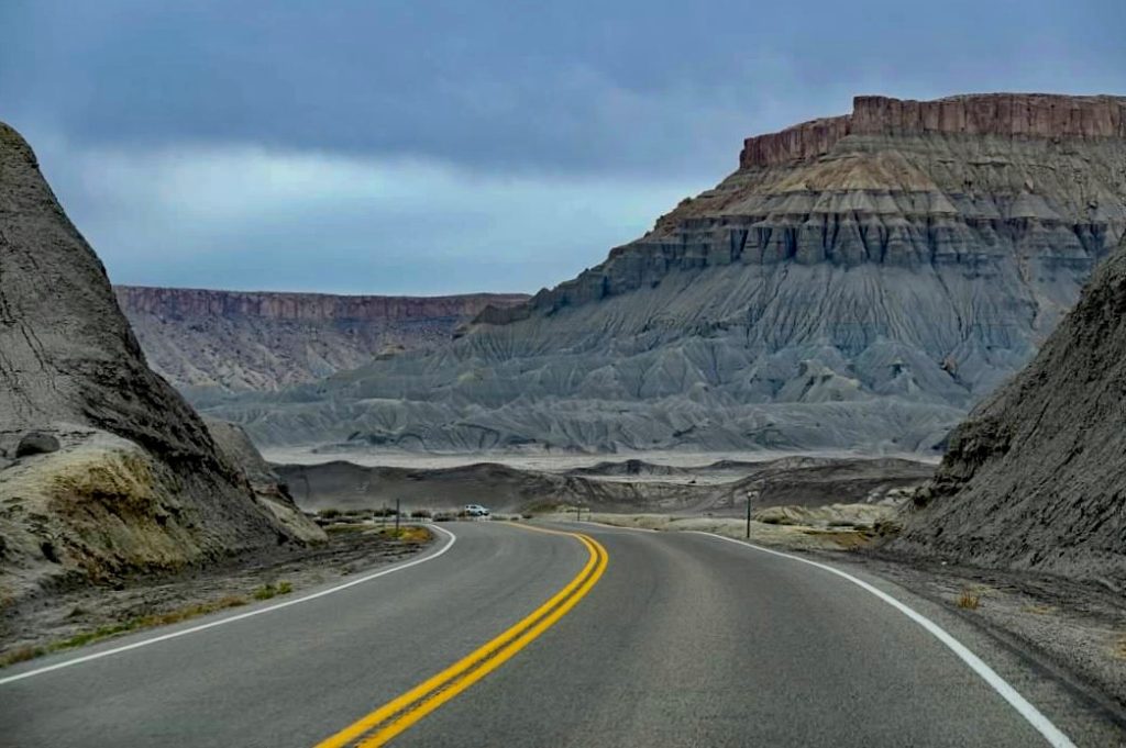
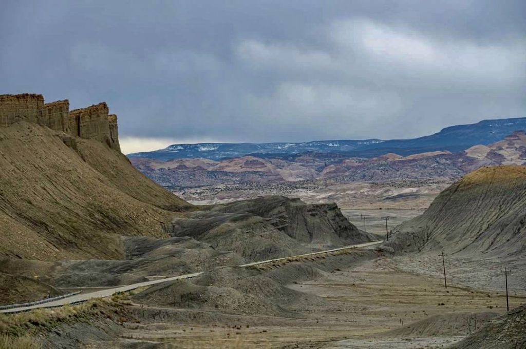
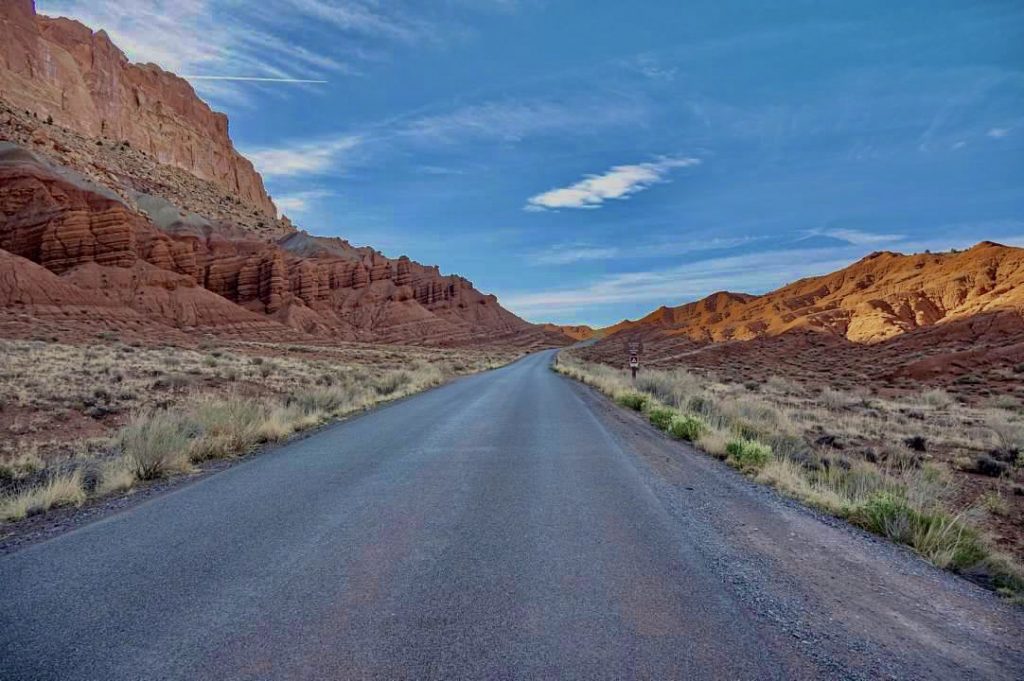
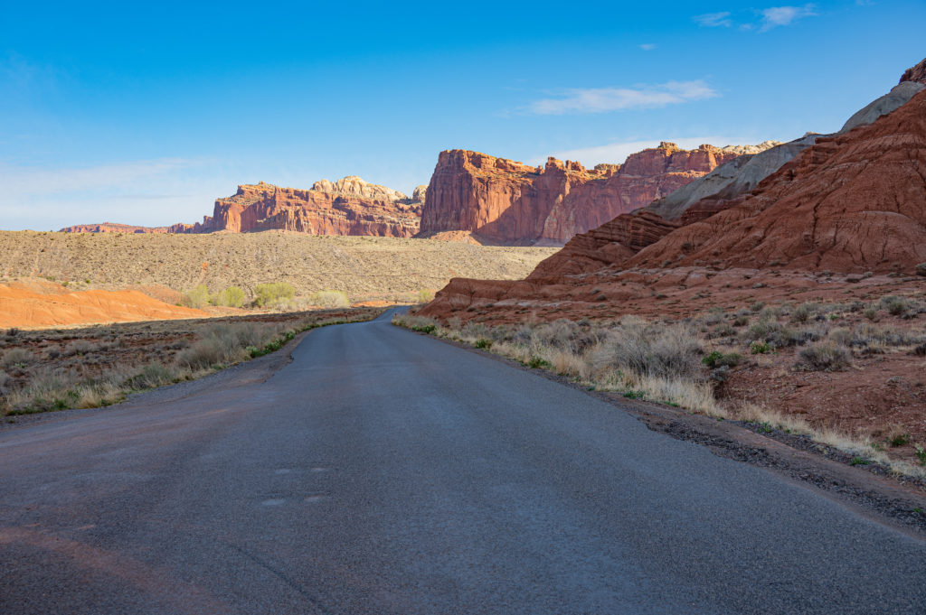
Highway 24 cuts through Capitol Reef National Park, and is free to drive with many sights and viewpoints marked, and via Highway 24 is how you access the park.
Highway 24 showcases Capitol Reef’s rock layers of deep orange hues against striations of gray, which began forming 280 million years ago.
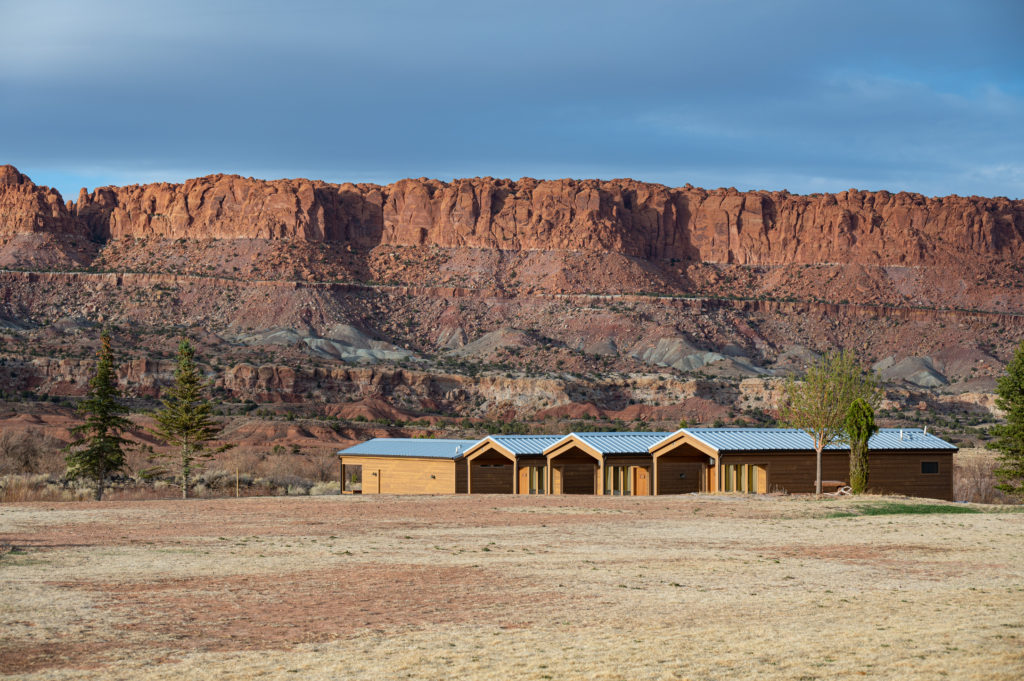
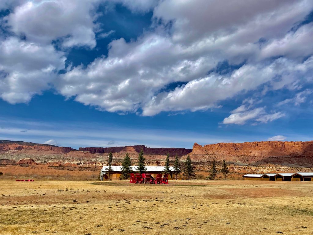
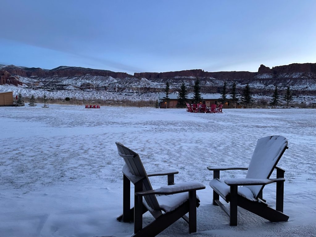
We arrived in the evening and stayed at Capitol Reef Resort, just 5 minutes outside of the park along Highway 24. You can reserve rooms, suites, cabins, wagons or glamping tipis.
The food at the hotel’s restaurant The Pioneer Kitchen was excellent, and while the kids loved the burgers, braised short ribs and wings, the vegetarian options were equally delicious such as the stuffed poblano pepper shown below. The dining room is a relaxing space surrounded by windows revealing Capitol Reef National Park and the high desert of the Colorado Plateau.
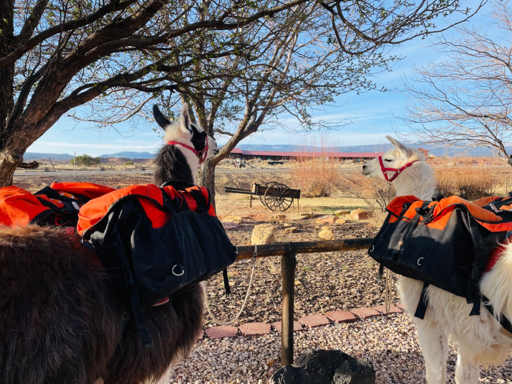
After dinner we relaxed before our early morning start. For those of you who are adventurous, you can book a pack llama excursion to traverse some of Utah’s most beautiful landscapes. After a hearty breakfast at the Pioneer Kitchen, we said hello to the resident llamas and then headed off to explore.
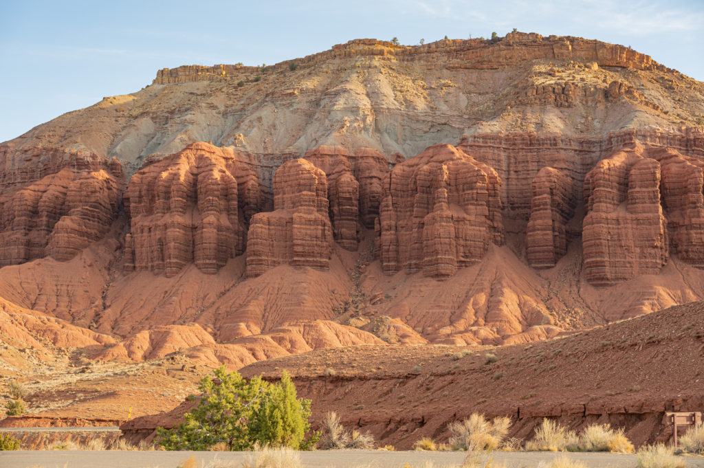
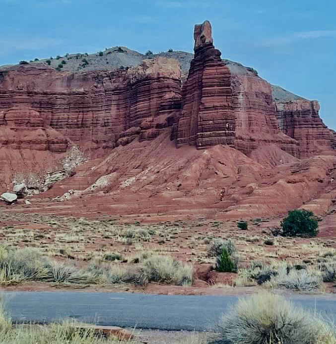
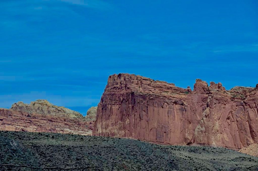
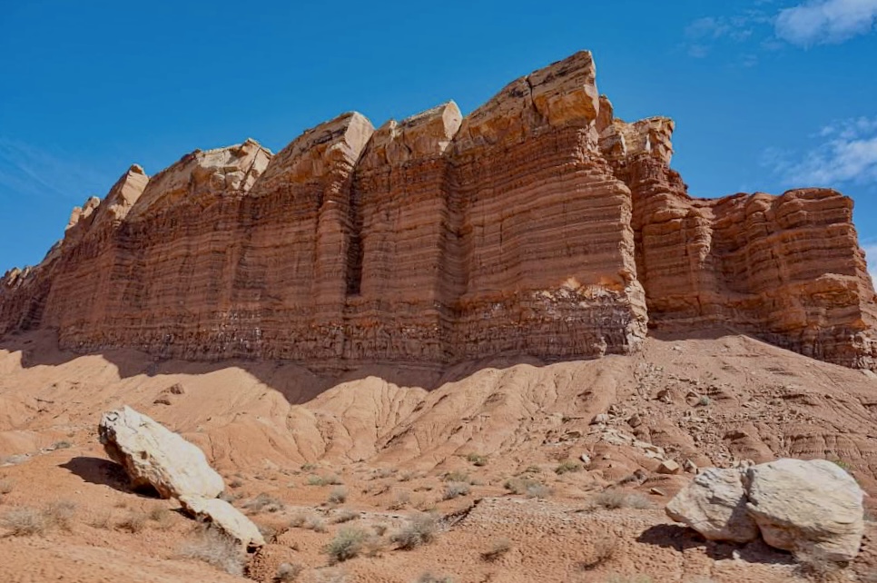
One of the 1st landmarks you pass as you enter Capitol Reef heading in from Torrey is Chimney Rock, a towering 400-foot-tall sandstone pillar created by differential erosion. Differences in the materials that make up the rock layers affecting how they erode from wind, water and gravity, has created the parks most iconic landmarks, such as this one.
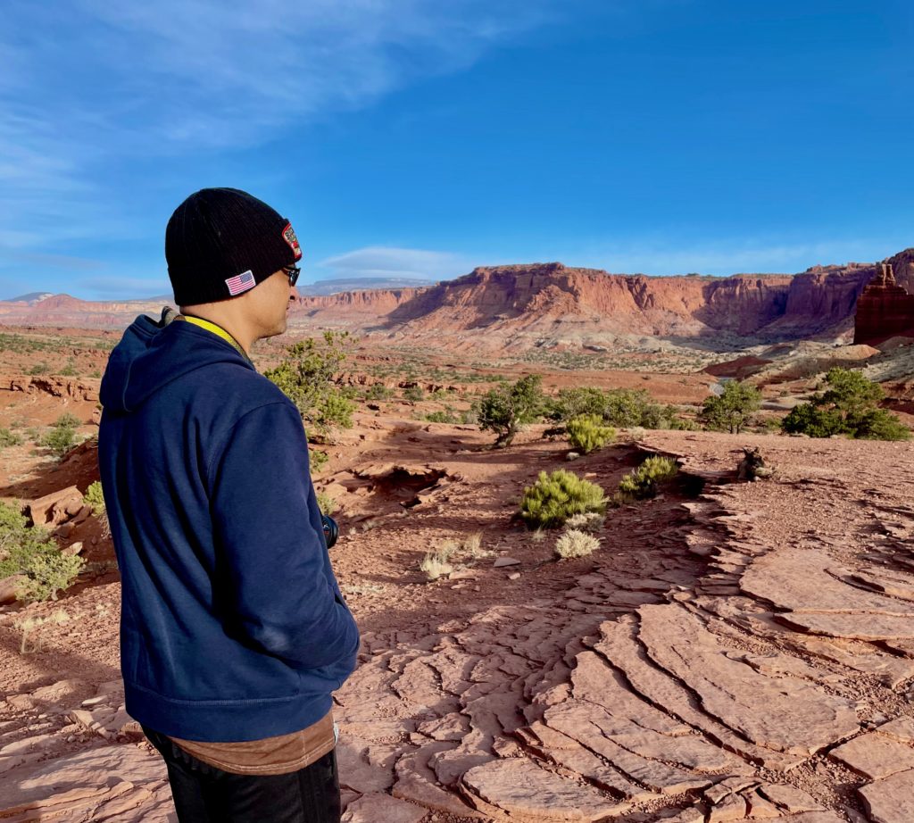
The 1st stop along Highway 24 is Panorama Point where you can pop out of your vehicle and simply take in the panoramic 360 degree views sweeping out in all directions.
Shifting tectonic plates uplift thousands of feet of rock like we see here, and this plate traveled through different climates as it moved from near the equator to its current location, where its appearance continues to evolving as wind and water shape the landscape.
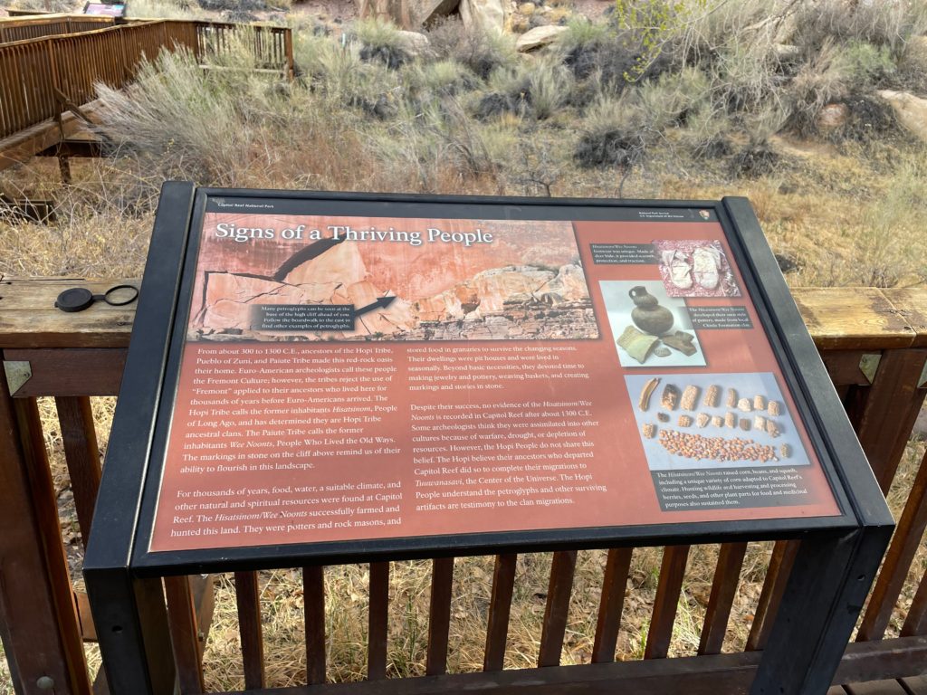
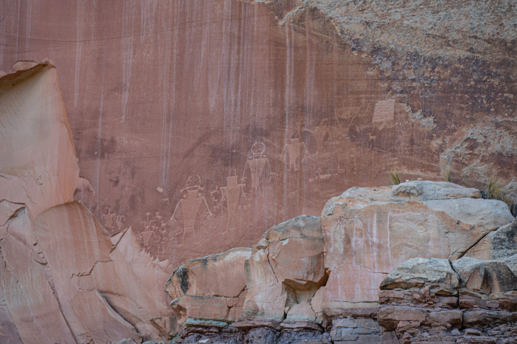
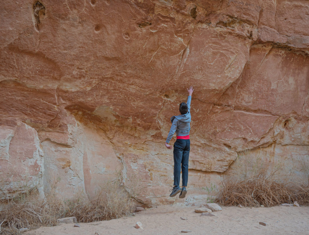
The 2nd stop just a few minutes drive down Highway 24 is the Petroglyphs, evidence that humans have been able to survive here for thousands of years due to food, water, and a suitable climate. These are handicapped accessible by two wooden boardwalks, but don’t let the photos fool you, the petroglyphs are small and not easy to quickly spot.
American Indians who lived in this oasis for thousands of years are believed to be ancestors of today’s Hopi, Zuni and Paiute, and archaeologists believe these petroglyphs they left behind were created between 300AD-1300 AD with a distinctive style found primarily through Utah and contrasts with petroglyphs in other parts of the American Southwest.
The 3rd stop is the Visitor Center, which is a great place to inquire with the park rangers about your planned activities so that they can advise on the day’s conditions. For example, my son was born with a rare genetic condition called Fragile X Syndrome which causes intellectual disability and other challenges during physical activity, but I’ve found that handicap accessible activities often work better for him so I usually inquire about accessibility so that we don’t bite off more than we can chew.
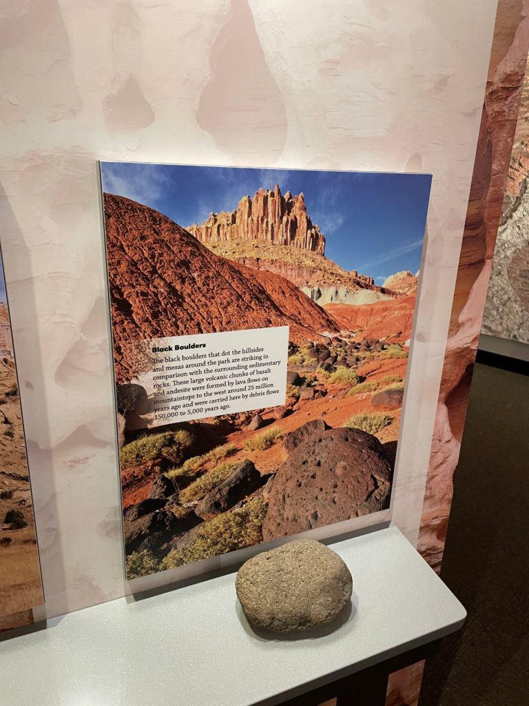
The Visitor Center is also a great place to learn about the geology of the park, and if you are short on time, click photos of the exhibits to read about them at your leisure, while you are at the sights if possible. There were descriptions and samples of the various rocks found in Capitol Reef which was helpful and fascinating. Don’t hesitate to leverage the employees working at the gift shop checking you out either, they’re usually local and a wealth of information.
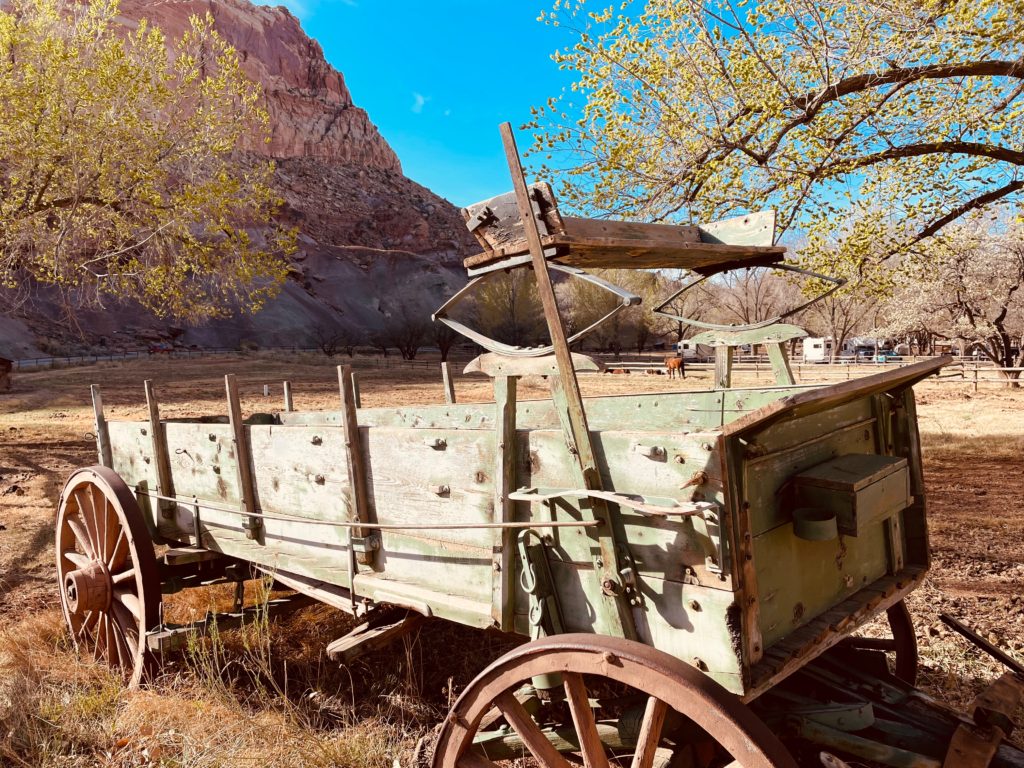
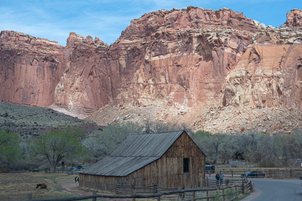
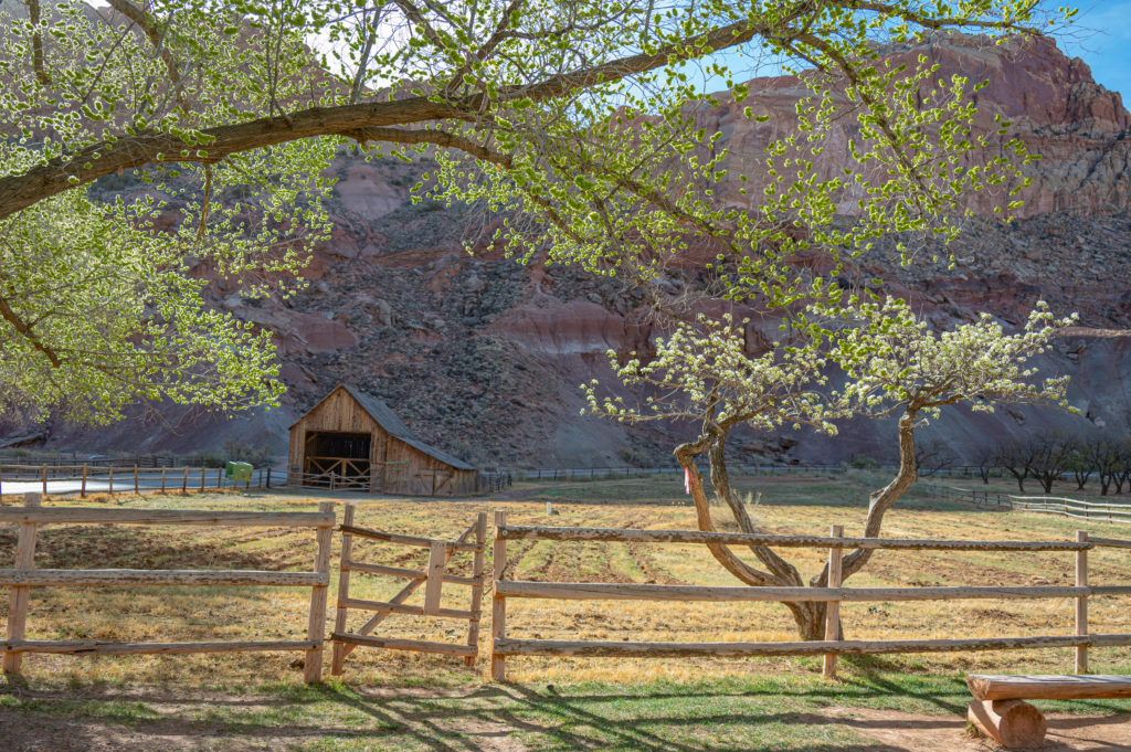
Leave the Visitor Center and begin the 8 mile scenic drive into the Fruita Historic District, a lush valley where Mormon pioneers settled in the 1880s, growing and raising nearly all of their own food from produce to livestock.
Workdays were long and hard where the first tractor didn’t arrive here until 1940 and so horse drawn equipment was used to plow fields and maintain roads.
Canning and drying of fruits and vegetables and smokehouses used to preserve meats sustained this community through the winter where living off of the land demanded ingenuity and hard work.
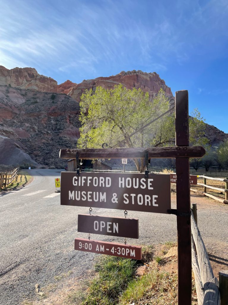
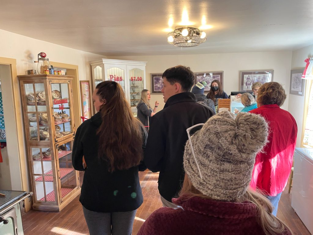
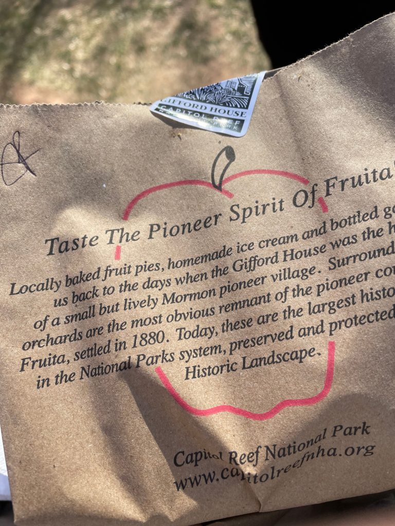
Locally baked fruit pies can be purchased from the Gifford House, the former home of a small Mormon pioneer family located in Fruita, the area that was settled in 1880.
The Gifford House is surrounded by orchards and there are picnic tables outside to sit down and enjoy your warm pies.
The settlers in this small community planted thousands of fruit trees in the fertile Fremont River Valley, which provided food and income to the families who lived here. Today the orchards contain 2,500 fruit trees and are preserved and protected, listed on the National Register of Historic Places.
Pick up your pies early in the morning since they sell out quickly, and then continue on the Scenic Drive past red towering cliffs formed from giant ancient sand dunes 200 million years ago.
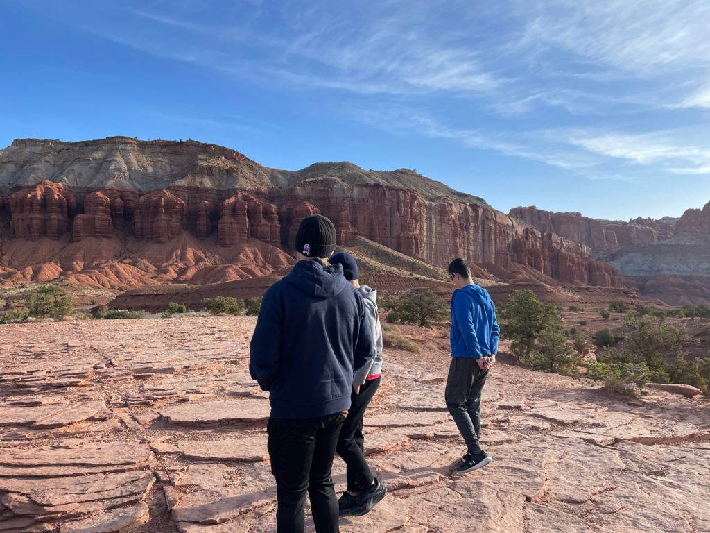
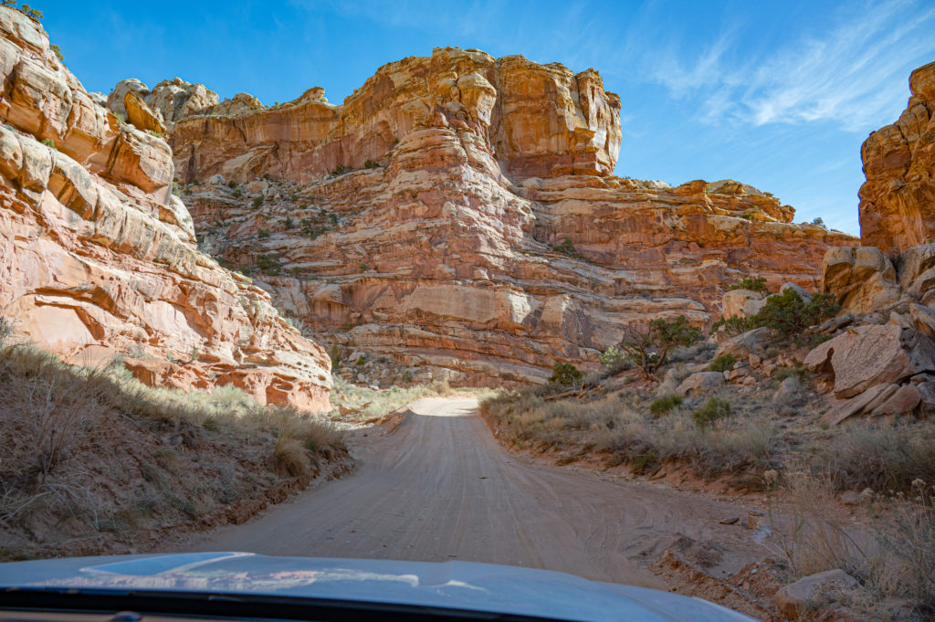
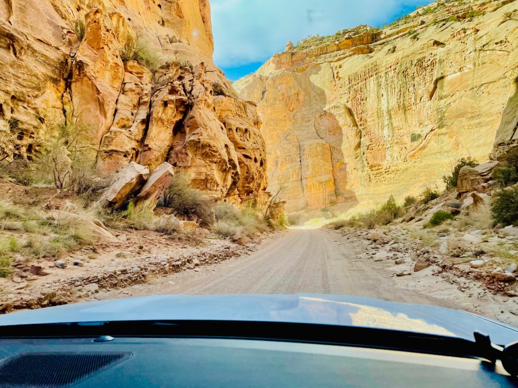
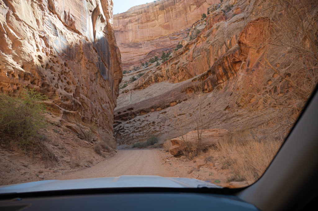
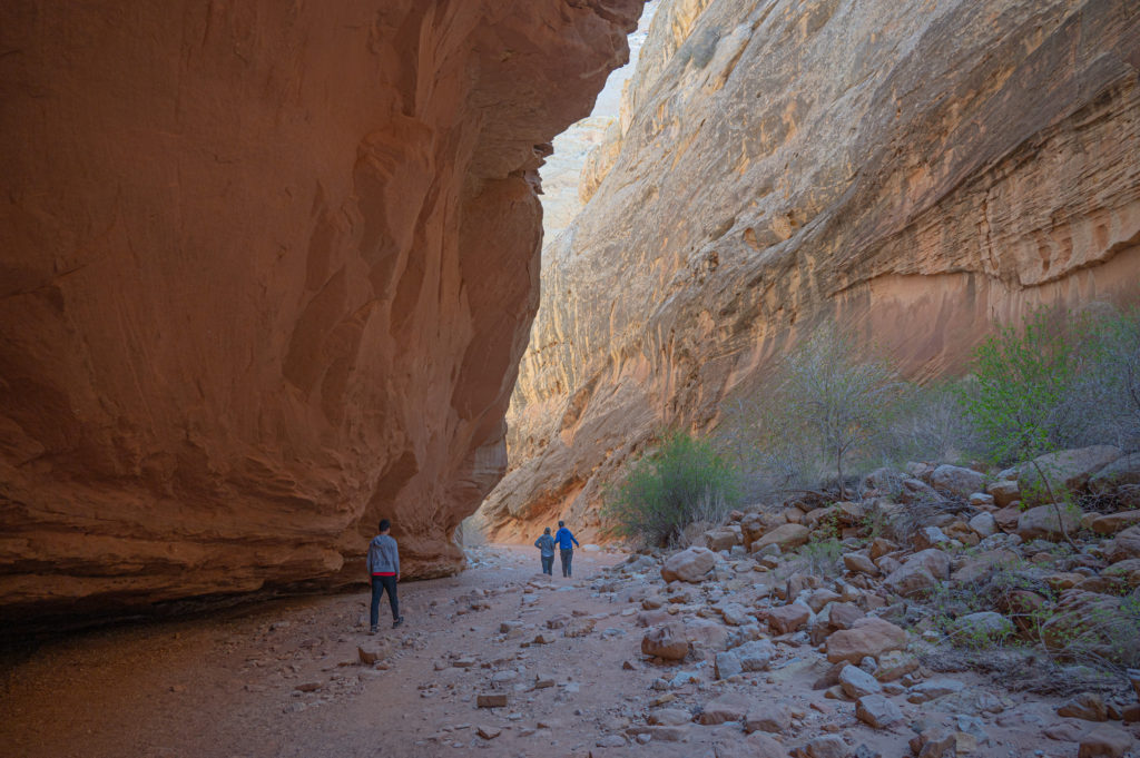
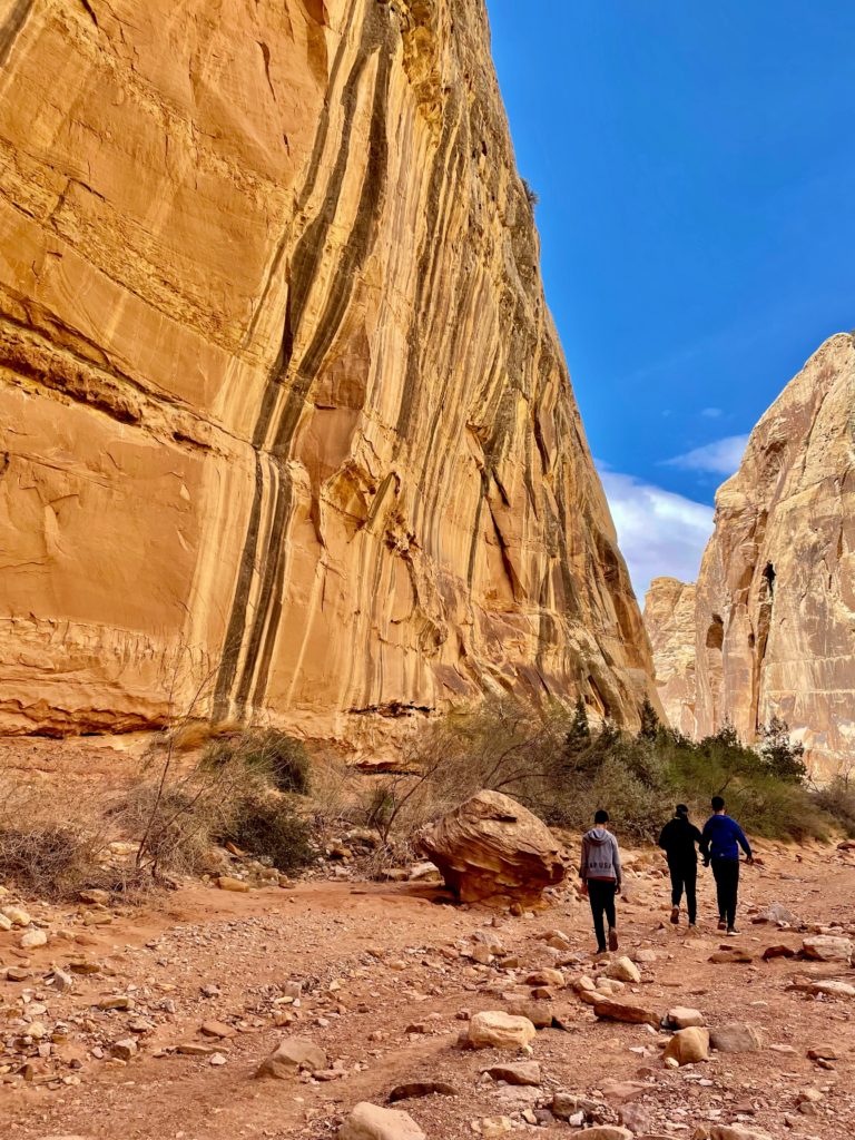
At the end of the Scenic Drive is Capitol Gorge Road, one of two dirt roads off of the Scenic Drive, which is where you will begin your first hike.
This park is almost entirely empty as compared to the other national parks in Utah so pulling off for photos was easy to do.
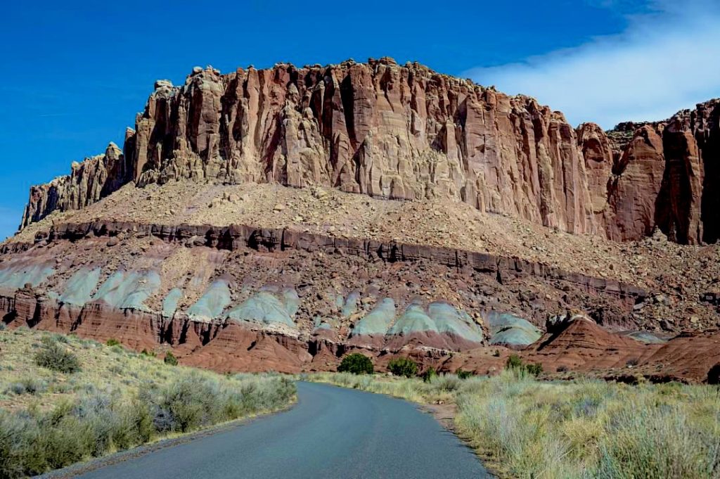
From this view on the Scenic Drive you can begin to see how the fault in Capitol Reef lifted rocks on the west side of the fault 7,000 feet higher than those on the east side of the fault.
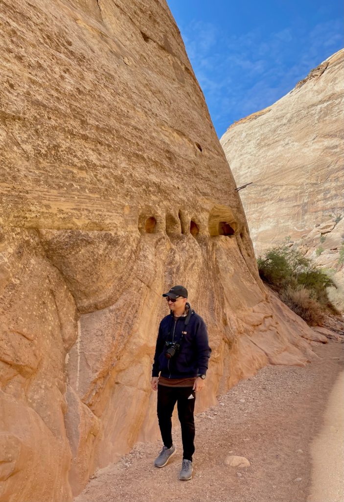
At the end of Scenic Drive you will enter the dirt road into Capitol Gorge, which leads to the trailhead as the road winds through canyons.
The dirt roads to Grand Wash and Capitol Gorge are usually suitable for passenger cars provided it hasn’t rained, and you can drive right into the dry streambed to the trailhead to hike the Capitol Gorge Trailhead.
The Capitol Gorge road is longer and more winding than Grand Wash, and although a through road from 1884 to 1962, the drive now ends in a few miles.
The road ends at the parking lot where there are restrooms and picnic tables where some hikers were enjoying their pies.
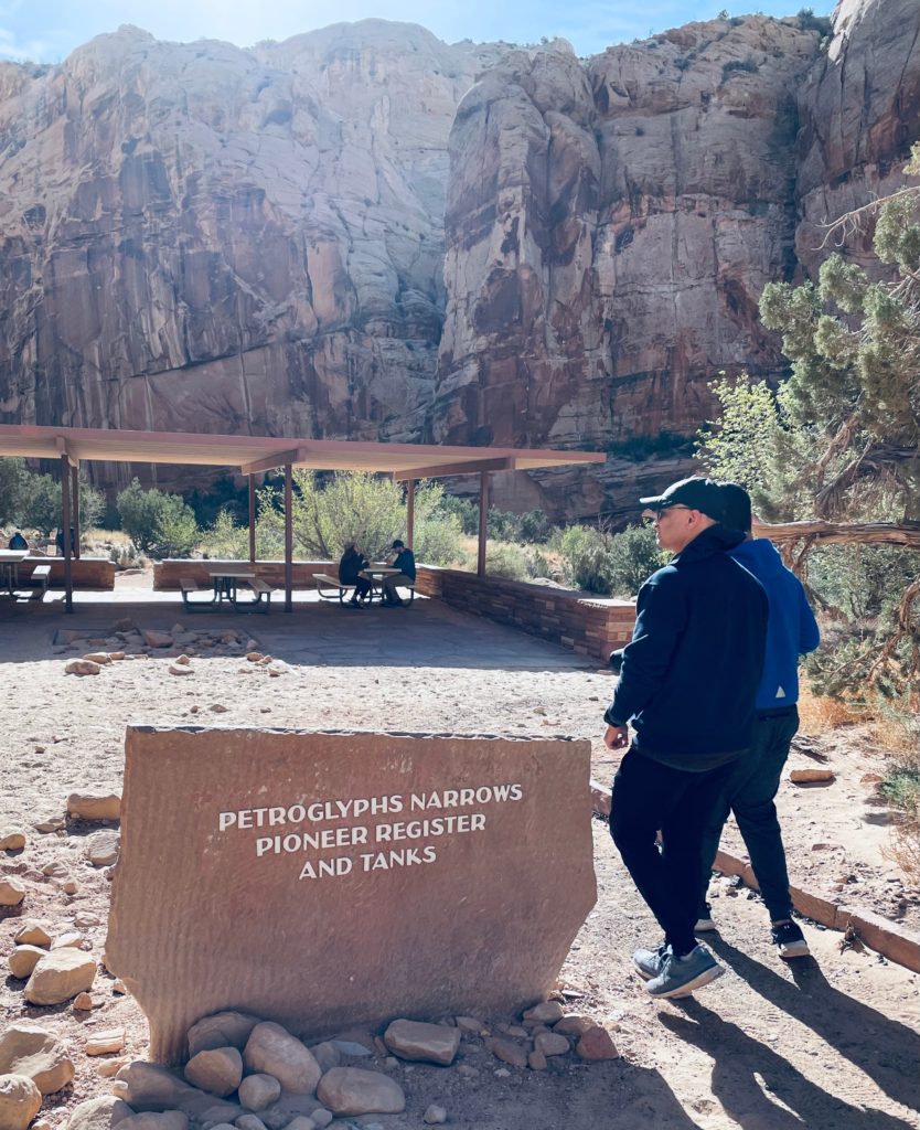
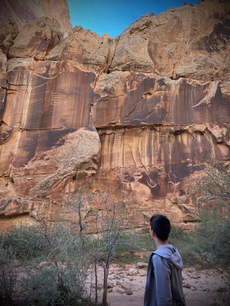
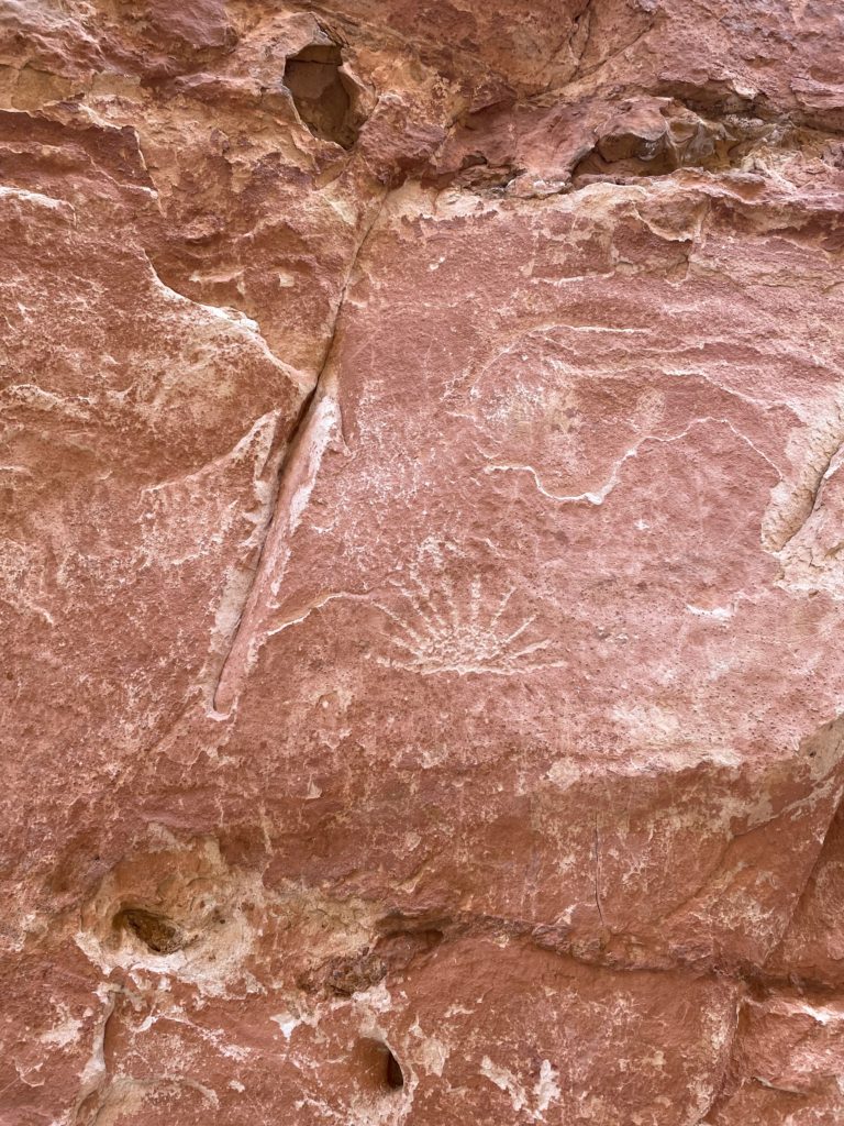
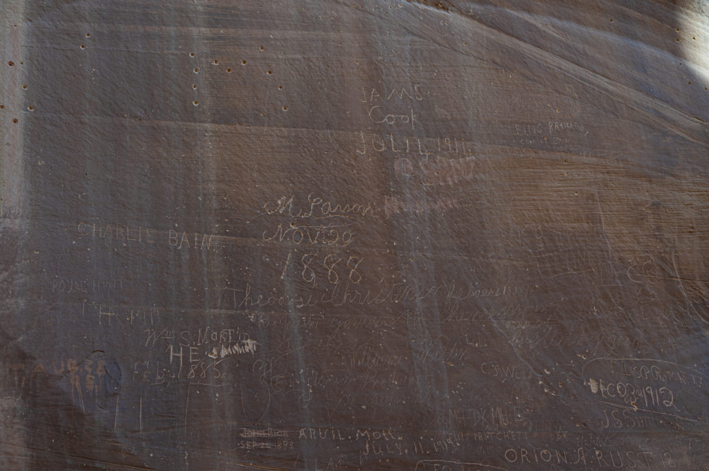
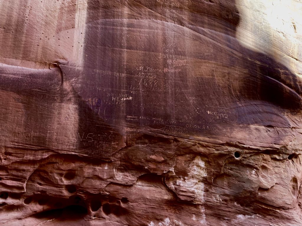
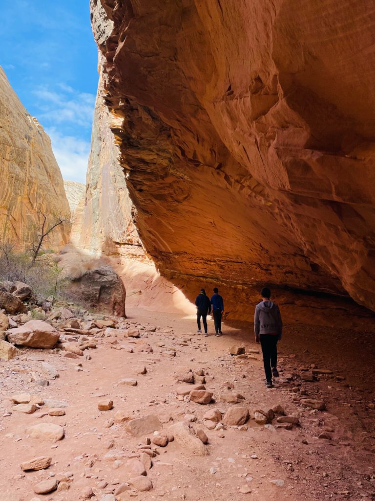
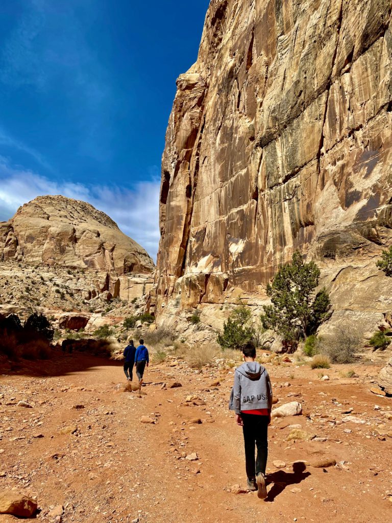
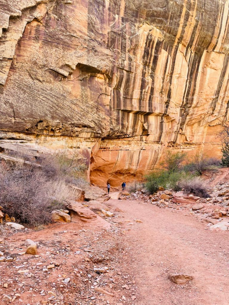
This easy 1 mile one way trail leads to prehistoric petroglyphs and the historic pioneer register comprised of of rock inscriptions from travelers passing through ages ago.
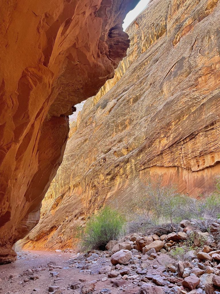
The yellow Dakota Sandstone formed in shallow water along the coast of a huge inland sea, which covered the Colorado Plateau about 95 million yeas ago, and if you look closely you can see fossils of oysters that lived on these ancient shores.
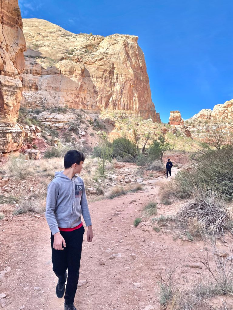
As you trace the same historic path of early settlers via this pioneer road through Capitol Gorge under towering cliffs, keep your eyes open and look up to often see the names of these pioneers carved into them.
There are numerous petroglyphs along the cliff walls as well created by Native Americans who followed these rivers and waterways, primarily by foot.
Early settlers had to remove heavy debris after every flash flood to maintain this passage.
However, early European American explorers still found it difficult to traverse with wagons and livestock.
Erosion is the primary geologic process you see at Capitol Reef today, where rains fill streams and canyons with an abrasive mix of water, sand and silt that scours hard rocks.
This historic route followed the dry streambed until the road was closed in 1962 when Highway 24 was paved.
Early travelers recorded their passage on the canyon walls here at the Pioneer Register, but don’t attempt to do so now since it’s not allowed.
These historic inscriptions are fascinating to look at and reflect on what it would have been like for those who traveled this road 150 years ago.
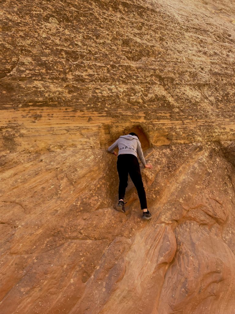
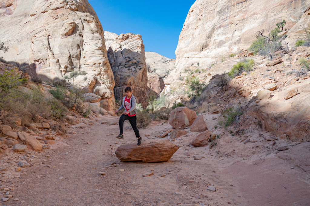
There’s no shortage of rocks to climb or jump from as you make your way through.
It’s very quiet within these 1,000 foot cliffs, and often you can hear the canyon’s winged residents including ravens and falcons.
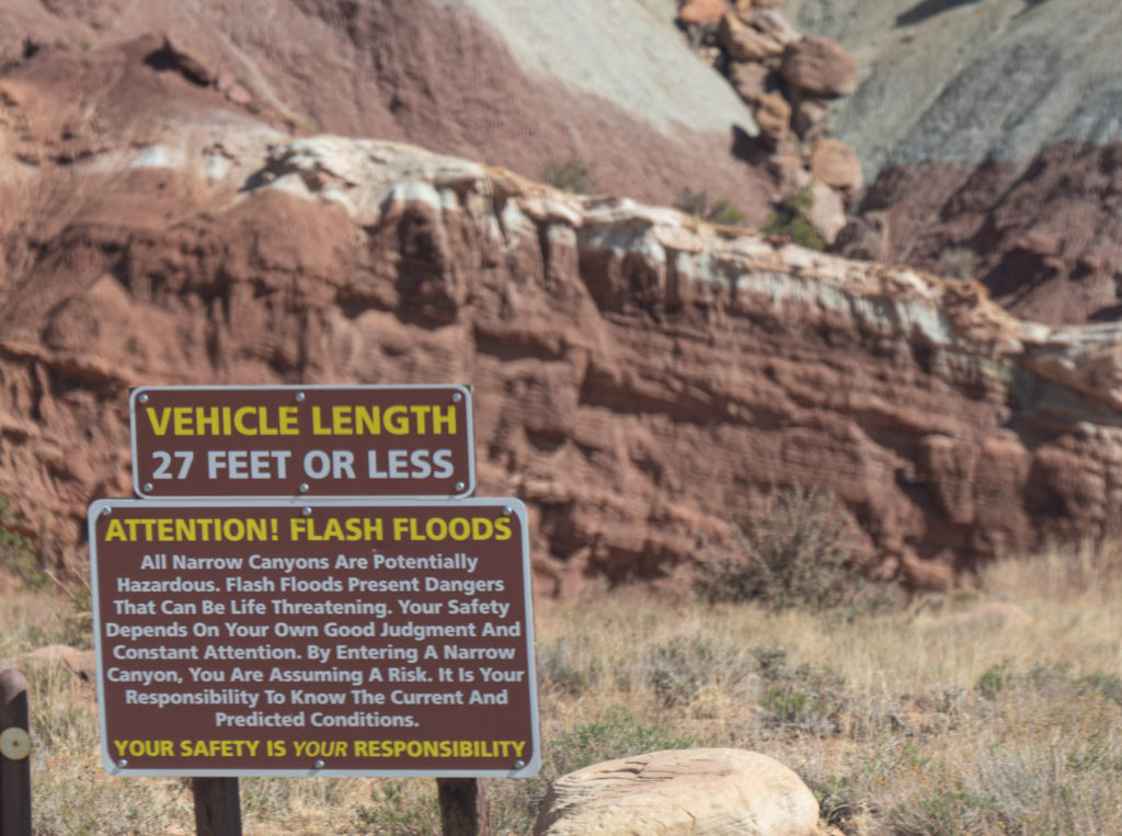
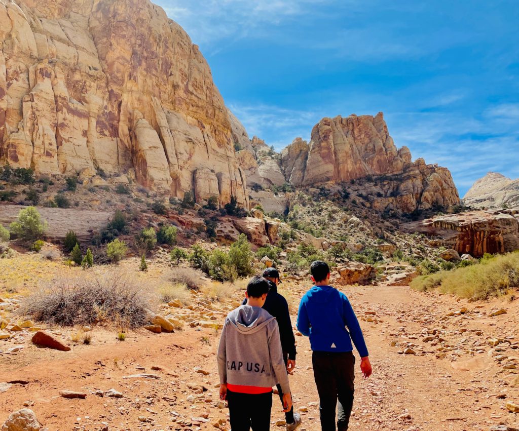
Next drive to the nearby Grand Wash trailhead as you make your way back up Scenic Drive, and take heed if rain is predicted since dangerous flash floods often arrive in canyons when it rains with little warning.
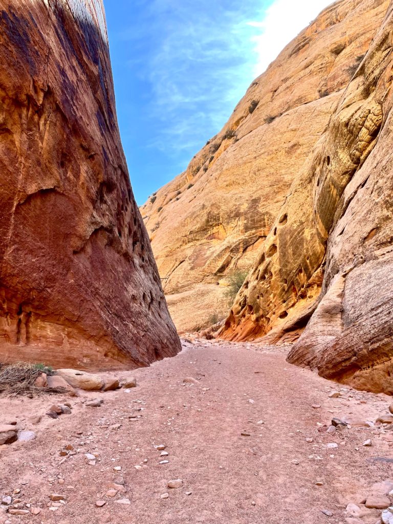
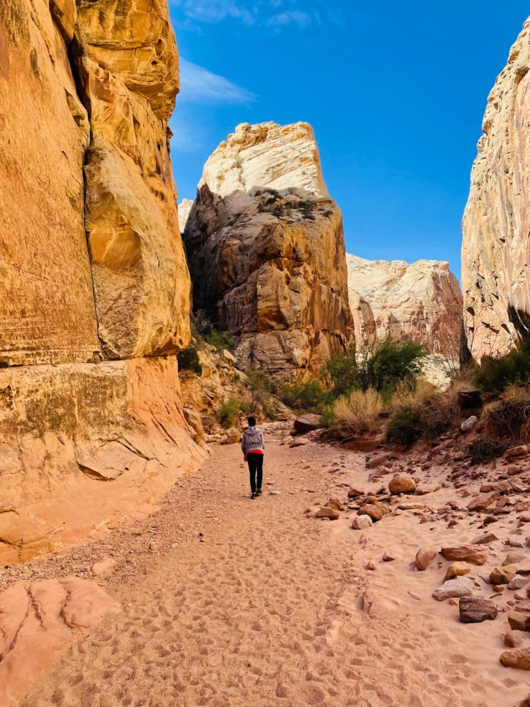
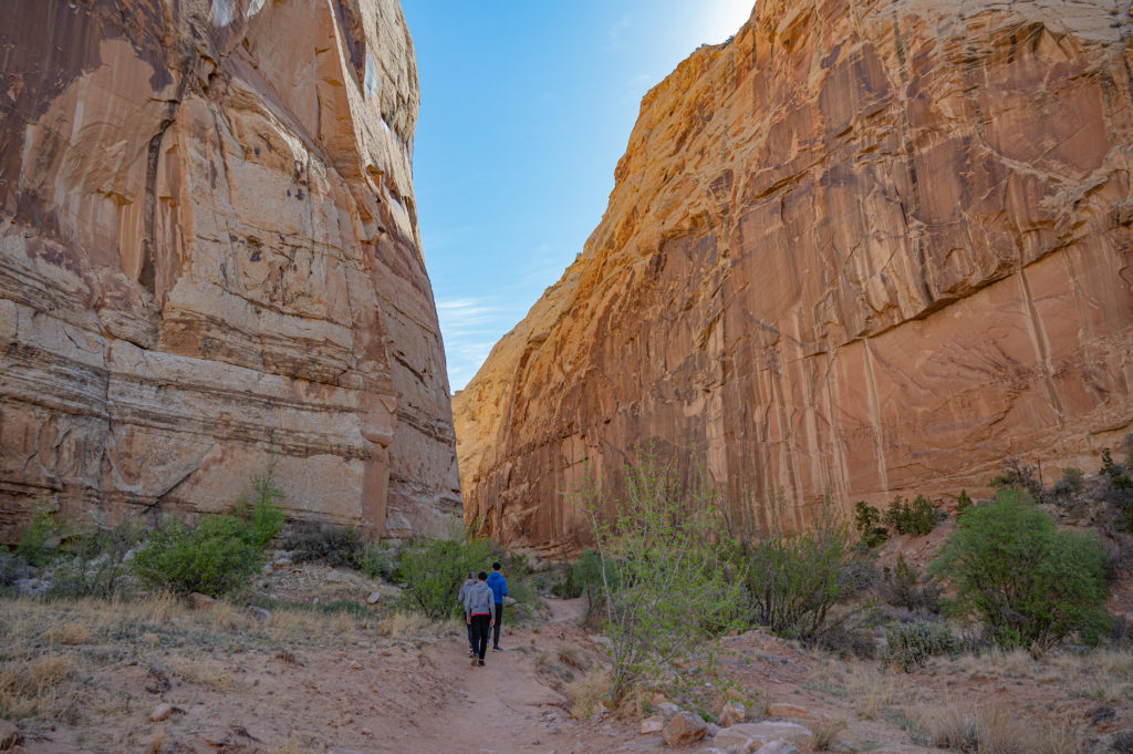
Grand Wash is a narrow, steep-walled canyon, and reportedly a hideout for the turn of the century outlaw and train robber Butch Cassidy, for which an arch in Grand Wash is named after.
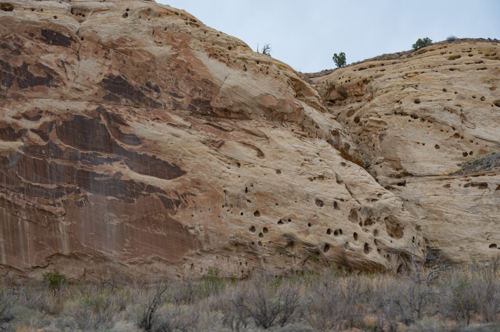
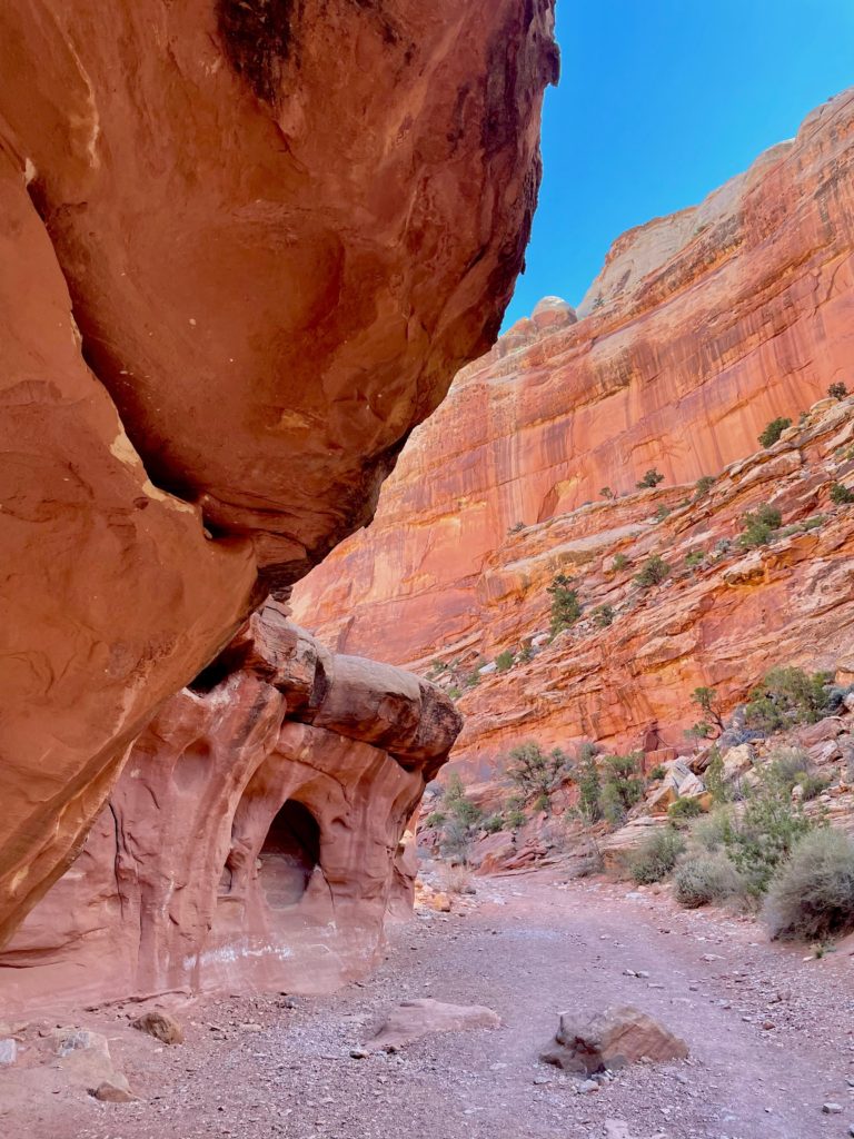
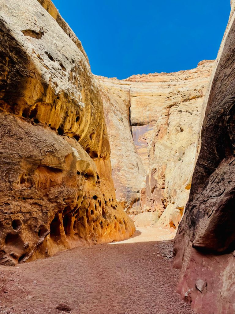
Grand Wash contains a lot of honeycomb weathering or “swiss-cheese rock”, called ” tafoni”, which are small, rounded, openings in a rock surface, most often found in arid or semi-arid deserts.
Amid soaring walls, specialized habitats support plant and animal life, and these cliffs created barriers to winds and storms, while rivers created corridors for travel.
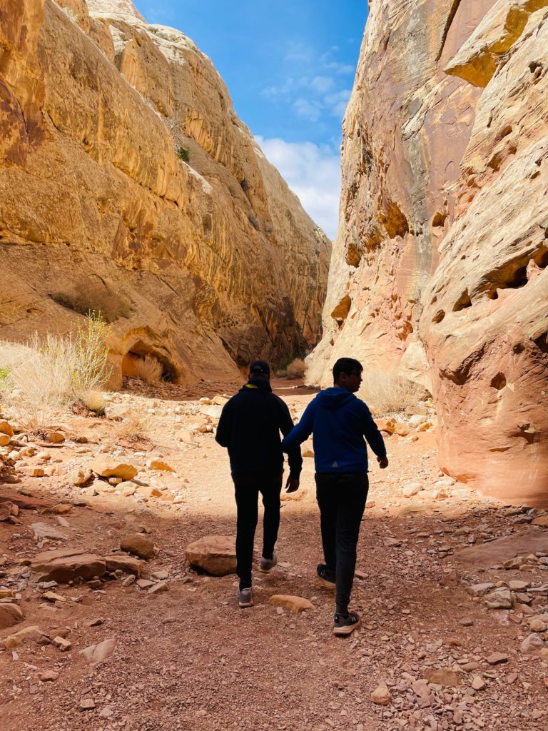
We passed a few fellow hikers who were coming from the opposite direction, but for the most part we didn’t share the trail with anyone else.
Dangerous flash floods and quick running streams carve away at softer mud and clay layers, undercutting cliffs, which later make for epic hikes.
It’s roughly 1.4 miles to reach these dramatic narrows on the Grand Wash trail which took us about 30 minutes.
The cliffs of Wingate Sandstone are windswept drifted dunes of an ancient desert and shallow holes in the cliff are created as water erosion removes more weakly cemented sand grains, leaving solution pockets and natural bridges.
The entire trail is 4.5 miles one way, but we turned around 1.5 miles in since we had explored what we read were some of the most interesting parts of the trail.
Water freezes in cracks, fracturing cliff faces, and wind continues to move sediment, which we experienced near the trailheads which were more open so wear sunglasses to protect sand from blowing into your eyes.
Although bare stone, or slickrock, dominates the landscape here, plants also are plainly visible. Channels and washes, although usually dry, carry water often enough to support a step shrub ecosystem.
What began as a cool morning quickly heated up by midday when we soon felt overdressed, so keep track of how far in your are, layer up so you can remove if needed, and carry plenty of water.
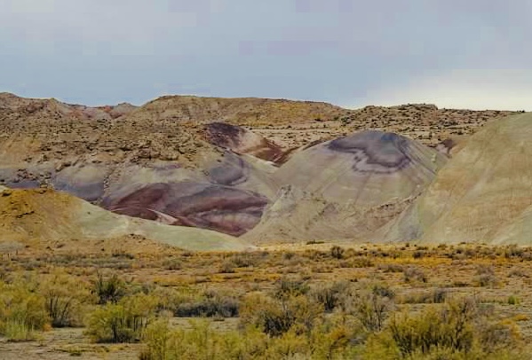
Most rock at Capitol Reef is sedimentary, formed in layers from loose materials, like mud and sand. Thin beds of reddish-brown shale were formed from silt and clay from waters of lagoons, mud flats, and coastal flood plains. This 225 million year old rock is the Moenkopi Formation, more than 950 feet thick in places, from a moist, tropical climate.
Sandstone, siltstone and clay mixed with volcanic ash over time to create the bands of color seen. The odd gray layer represents a wet, swampy environment from 215 million years ago, which was not highly oxygenated, and so the reduced iron produces the gray.
The visible rock layers show sediments from oceans, swamps and streams collected near sea level, and winds blew sand into dunes that were cemented into rock.
The black rock was formed by volcanic lava flows 25 million years ago, and is striking in comparison to the red stone, and it is also the youngest rock in the park from the Age of Mammals.
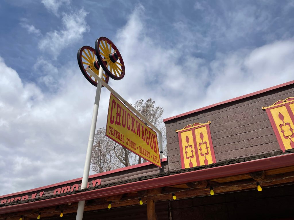
Many visitors spend their day inside the park, so we found lunch options outside the park to be limited, and even our hotel restaurant closed during lunch. In Torrey you can stock up with all sorts of goodies from the deli at the Chuckwagon’s general store.
We also grabbed some whipped cream from there to have with the cherry pie we purchased from the Gifford House earlier in the day.
The views outside of our suite complemented the cherry pie perfectly.
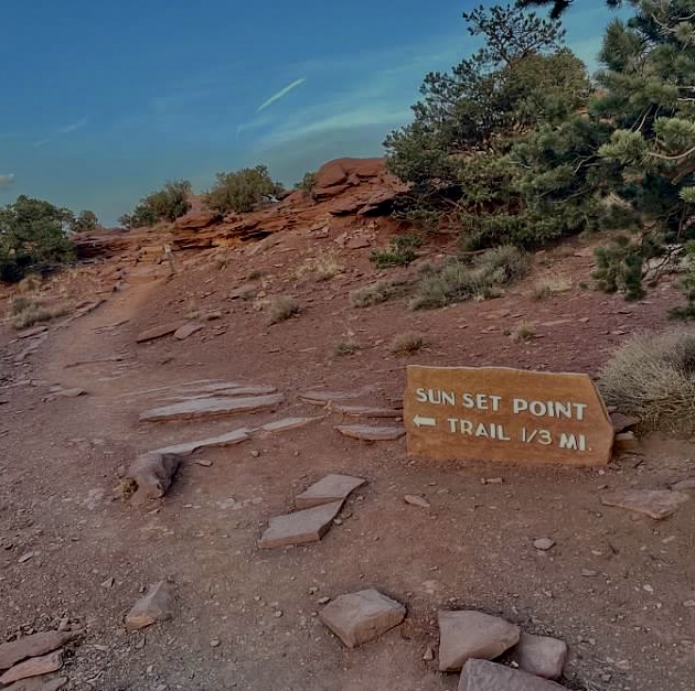
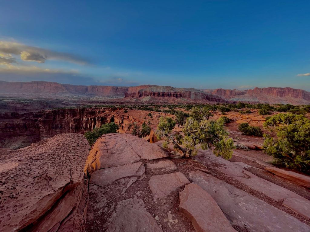
The most dramatic lighting of the day is early morning or late afternoon, and so head to Sunset Point just right inside the park to watch the sunset.
It’s a short hike to Sunset Point from the parking lot which only took 5 minutes.
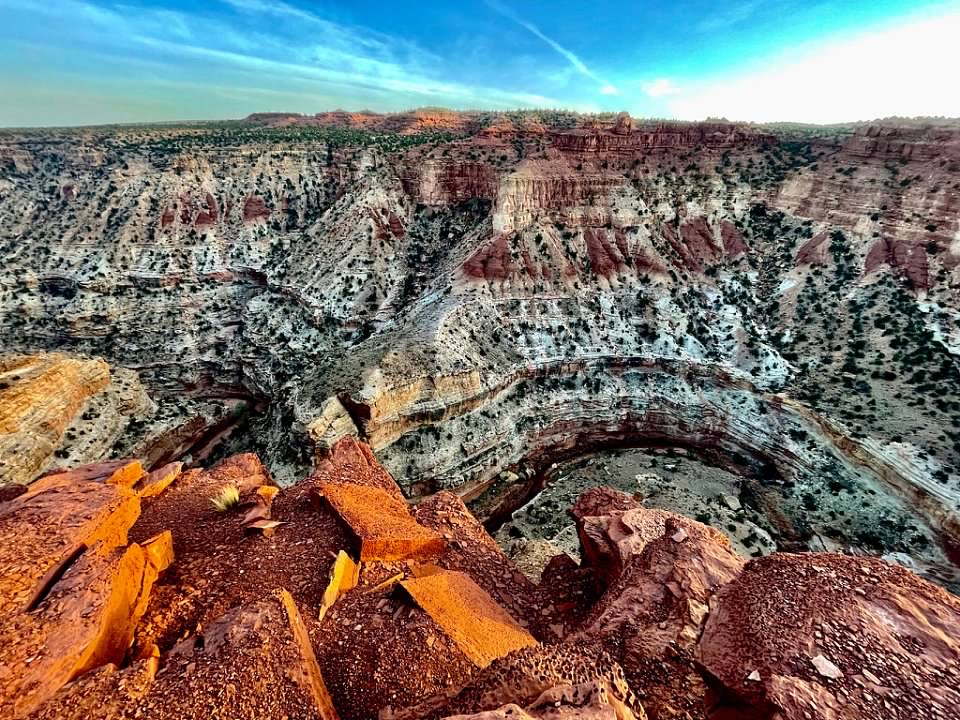
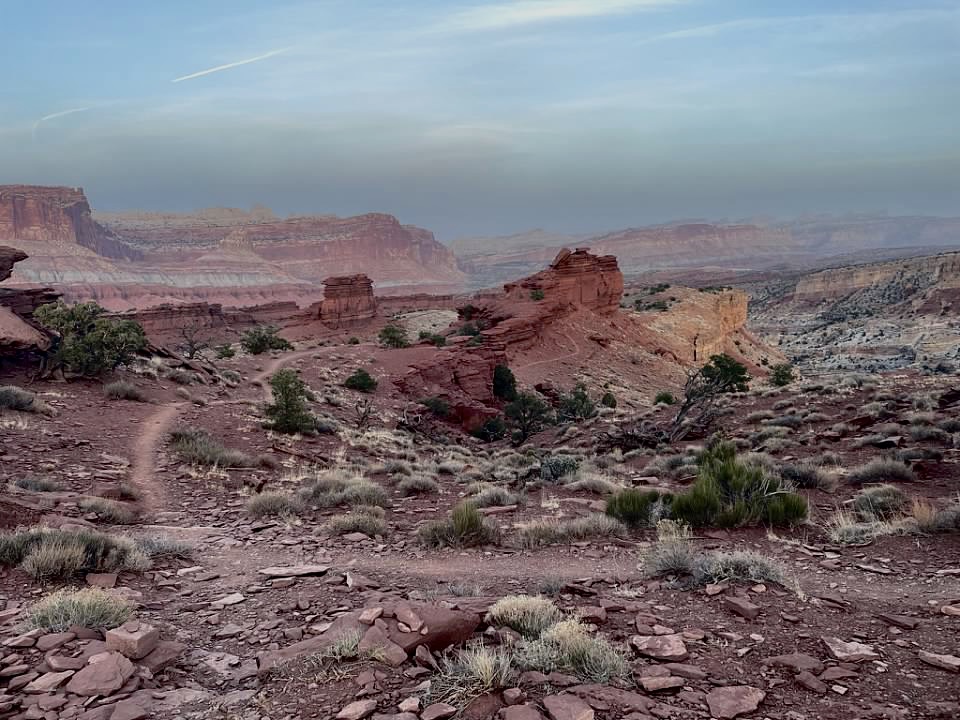
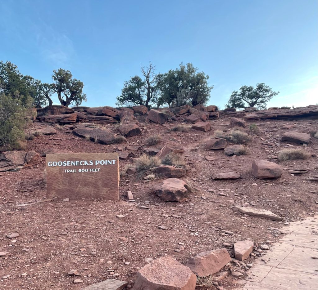
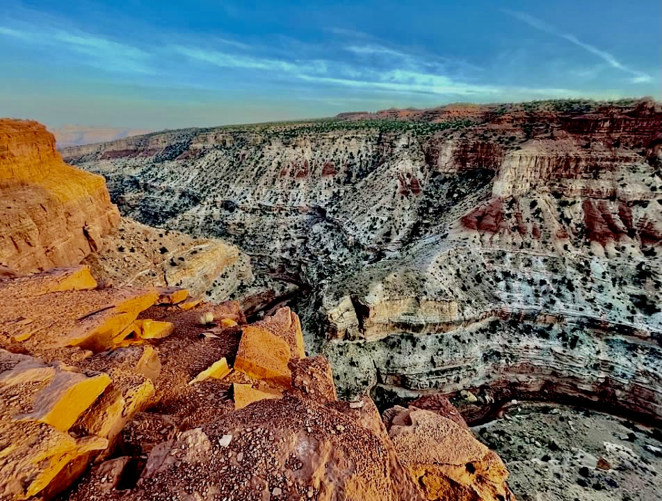
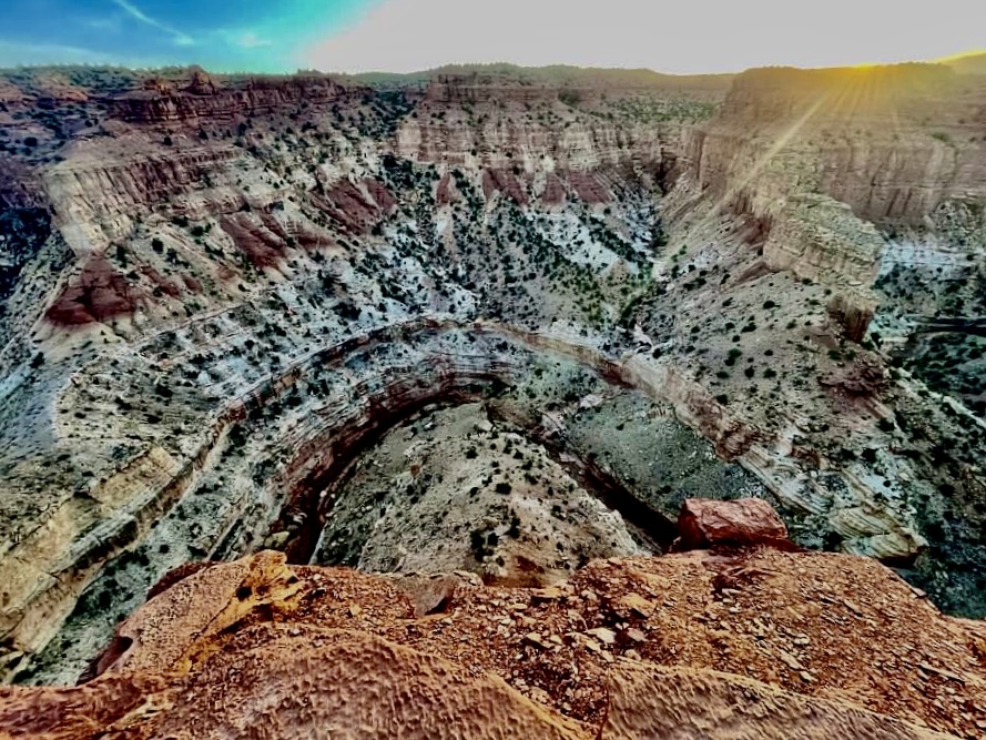
Next to the Sunset Point trailhead, Goosenecks Point on the other side of the parking lot offers spectacular views of Sulphur Creek.
Over millions of years landscape alternations including a swamp drying, a river changing course or a shift in climate, adds up to monumental transformations, and still continues to shape the park.
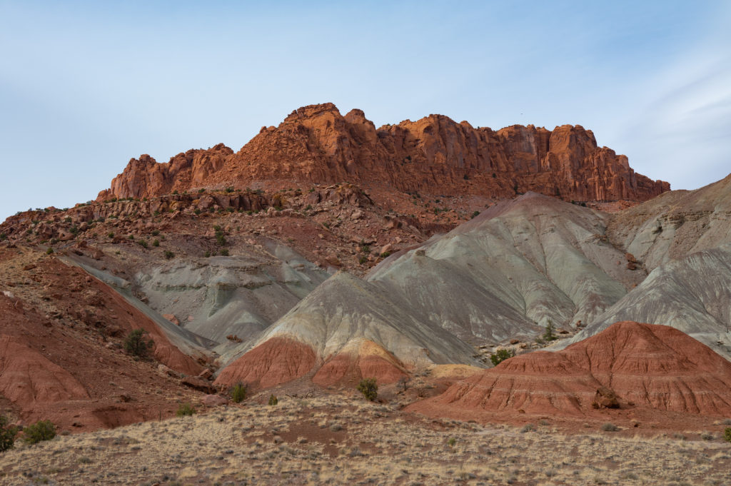
The Waterpocket Fold is Capitol Reef’s centerpiece, a nearly 100 mile long wrinkle in the Earth’s crust, and one of the most beautiful geological masterpiece’s you’ll ever see. The white layer is Kaibab Limestone, a shallow sea deposit.
Nearly 800 feet below is Sulphur Creek, a tributary of the Colorado River, which continues to shape this deep canyon as it erodes downward exposing older rock layers allowing an even deeper view into the past. There are no railings, so take extra precaution when you peek over these windy edges and do not leave children unattended.
Conditions change quickly, and after a warm day hiking, we woke up to snow and ice covered roads in the morning, grateful and relieved we had explored the park the prior day since ice would have made hiking conditions extremely hazardous.
Slow geological actions created this most dramatic landscape, and while this national park flies under the radar, it won’t be for long. Go.